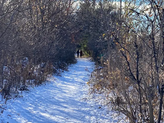
On a cold day after the first snow has fallen...
Friday, December 10, 2021
Tuesday, December 7, 2021
Old Photos of the St. Pierre River
These photographs are saved from a Facebook page, Historical Montreal Photographs.
 |
| Photograph of the St. Pierre River, from the McCord Museum looking south towards a bridge at Western Avenue, at The Glen in Westmount, in 1889. |
 |
| This, and the following photo, are from 1 June 1938, of a concrete bridge over the St. Pierre River. I think this might be at Westminster Avenue near the future Westover Avenue. |
 |
| See above. |
 |
| A 1903 map showing where the St. Pierre River emptied into the St. Lawrence River. |
Sunday, December 5, 2021
Historical Maps of the St. Pierre River
 |
| This map, showing the St. Pierre River (in 1696?), is found in a history of Loyola College; you can see the river on the top right and how it forms the Petit Lac St. Pierre in the bottom foreground. |
 | ||
Another old map, from 1744, showing the Island of Montreal, surrounding areas, and St. Pierre River.
|
Friday, December 3, 2021
St. Pierre River on a Cold Day
Photos taken on 28 November 2021 after the first snowfall.
It was a cold day but there were dog walkers and their dogs, and always a friendly "Good Morning". Why is this creek so important to people? Why not build more condos? Someone told me that the golf course is protected from future development. I hope they are correct. But why are people so adamant that the golf course should be protected and, by extension, that the river-creek not buried? All I can say is that, personally, I think we've had enough progress and development at the expense of our environment. We need to preserve some nature (not just parks) in the city for future generations, including land and a place for urban wildlife. This isn't a park, it's a golf course, and one day I hope it is allowed to revert to its natural state, let the grass grow and wild flowers thrive. Call it Parc St. Pierre and keep it undeveloped; it could be similar to Parc Angrignon.
What is covered can be uncovered and, I suspect, some future generation will see the St. Pierre River restored, above ground, in at least a few places. That is my hope.
BTW, in this area, there have already been several new condo developments, several new residences for the elderly, and both Vincelli's Garden Centre and the Village Plaza on Robert Burns are slated for being demolished and apartments or condos built on these sites. Enough is enough.
 |
| Train tracks on the left that you pass to enter the golf course. |
Wednesday, December 1, 2021
Walking to the St. Pierre River
Monday, November 29, 2021
Visiting the St. Pierre River
An article in the Montreal Gazette (Friday, 19 November 2021), "City to Bury St-Pierre River on court order", got me to finally visit what is left of the St. Pierre River, and I am glad that I did. I've been interested in the St. Pierre River for several years, but as for visiting this last surviving section of the river, it never happened until the other day. My only experience of the river was when walking through the underpass on Westminister Avenue just above Cote St-Luc Road, you can hear the sound of the river as it runs through underground pipes. Today, located in Meadowbrook Golf Course, you can see the only part of the St. Pierre River still above ground, and this will soon be buried. The Gazette article says that the river is polluted, so surrounding trees should be cut down, and the river should be buried, not exactly an approach that fits into our present age of conservation and climate change. In fact, the more I think about it the more ridiculous it becomes, what ever happened to cleaning up the source of the pollution.
Other cities have buried their at-the-time inconveniently located rivers and some of these cities are working at recovering--better to say, "uncovering"--these rivers. Here we are making sure whatever is left of the river is buried. Sometimes I think of how different Montreal would be had the St. Pierre River not have been buried. Imagine owning a house in the city with a creek running by in the back yard; okay, maybe you wouldn't like this but this is something some of us would love to have. A friend in Baltimore grew up with the Herring Run River across the street from where he lived and where lived later in life. Birds, wild life, even deer could be seen going to the river, it's a green space for animals and people, a sign that some little bit of nature still exists. But it is not to be here.
Personally, I think this court order only suits developers who have big plans to build on the site, no doubt just what we need, more condos. I am told that the site is protected but, as with most things, I am a skeptic. Here are photographs I took of the St. Pierre River the other day.


